Inicia sesión
Crear actividad
Tipos de actividades
Centro de ayuda
Introduce tu Game Pin
Blog
Premium
English
Español
Français
Crear actividad
Inicia sesión
Todas las actividades
Jugar Test
Imprimir Test
MAPS OF THE EARTH
Author :
Aguasantas Cano
1.
The numeric scale of a map is 50,000,000. What is the real distance (in km) between two place if the size on the map is 7 cm?
A.
350 km
B.
35 km
C.
3500 km
D.
35000 km
2.
... is the distance, measure in degrees, from any point on Earth to the Equator.
A.
Latitude
B.
Longitude
3.
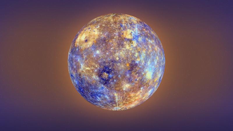
What is the closest planet to the sun?
4.
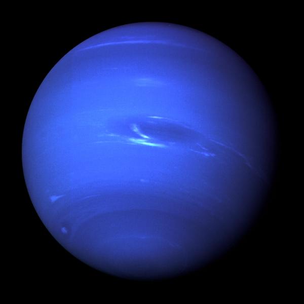
What is the planet farthest from the sun?
5.
Choose the correct sentence.
A.
Maps represent the Earth in three dimensions.
B.
Longitude is the distance, measured in degrees, from any point on Earth to the Equator.
C.
Key means "leyenda" (in a map).
D.
Physical maps show the boundaries between countries or regions.
6.
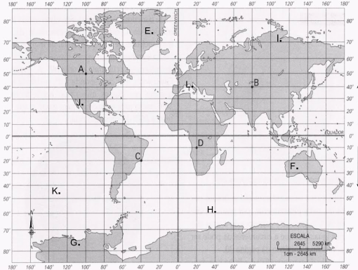
Write the geographical coordinates of A.
7.
Write the geographical coordinates of H.
8.
Write the geographical coordinates of H.
9.
Write the geographical coordinates of H.
10.
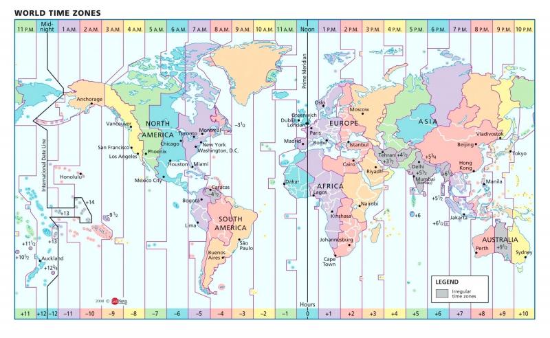
It is 8 am in Perth (Australia). What time is it in Sidney?
A.
6 am
B.
6 pm
C.
10 pm
D.
10 am
11.
If it is 14:00 in New York, what time is it in San Francisco?
A.
10:00
B.
18:00
12.
What is the meaning of distorted?
13.
What is the meaning of axis?
14.
Everything south of the equator is in the...
15.
The opposite of north-west is....
A.
north-east
B.
south-east
C.
south-west
16.
What Tropic is in the Southern Hemisphere?
17.
Which hemisphere is Spain in?
18.
It shows a specific thing...
A.
A globe
B.
A physical map
C.
A thematic map
D.
A political map
19.
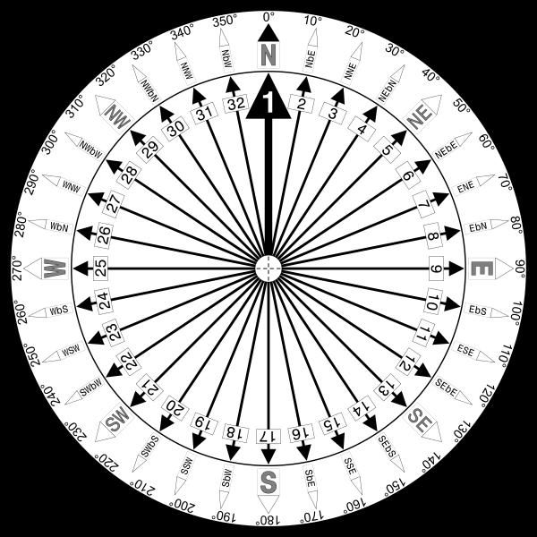
Instrument that shows direction.
20.
It shows the Earth on a flat surface.
21.
Half of the Earth.
22.
What time would it be in the Canary Islands if were 9 am on the Iberian Peninsula?